

 After the snow experience, I decided I'd better find portions of the PCT to hike which were at lower elevations. Another PCT access point not far from my father's home was the PCT cross point at Highway 74 just before it descends down to Palm Springs. The starting elevation was 4800' and I was able to get the 20 miles I desired. I went 10 miles in and 10 back, with an elevation gain of over 2000'. The wildflowers were wonderful and I wasn't prepared to see such beauty. But, this is spring and that is wildflower season in any Southern California year. Growing up as a young man in Los Angeles I never realized such beautiful flowering occured in the deserts of California. Of course, at that time I was more interesting in the size of my biceps than I was in the wonders of nature. Here are some pictures from that trail that day...


When I arrived at my turn around point, 10 miles, I met three young men taking a break very near the trail. I asked if I could take my break with them and they were eager to accept my request and talk with me. They were three Israeli soldiers who had just been discharged from there duties in Israel. They decided together to hike the Pacific Crest Trail and were amazed at the scenery thus far experienced. The other hikers who started out with them at the Mexican Boarder gave them the trail name, "The Israeli Gears", because they marched in step with each other and looked very mechanical. They invited me to keep up with their blog on line and to join them for part of the hike once they got up around Portland Oregon where I live.
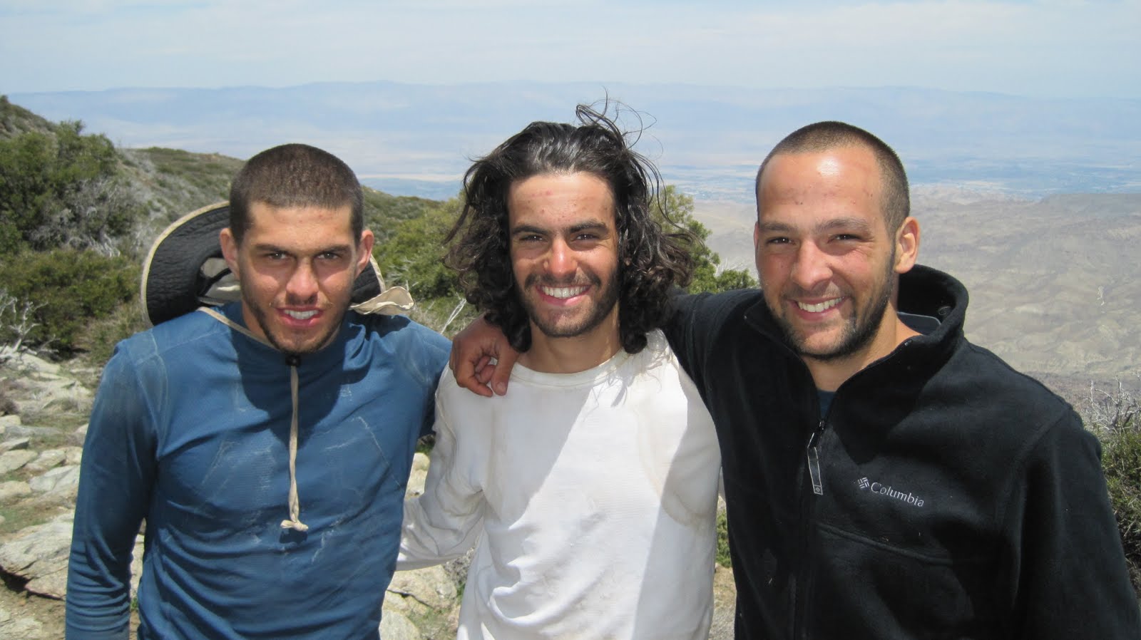 From Left to right: Tom, Yashov, and Ishai.
As I headed back to the starting point I encountered a not too friendly Western Diamond Back snake on the trail. He was lying right in the middle of the trail and I just about stepped on him. He was oblivious to me until I turned around and faced him. Then, he coiled up, shook his rattle at me and tried to scare me off. Hiking in Southern California is not all glorious, but he was a beautiful creature, even though potentially deadly.

I spent my last full day in Southern California hiking the Pacific Crest Trail from Interstate 10 up through White River Canyon. This was desert hiking at its finest. The weather was mild, the flowers were at there peak blooming, and I put in 21 miles without too much strain. I was sore by the end of the day, but not too fatigued. One month later and I would have been drained from the intense heat. Here are just a few of the photos I took that day...


 It was early October and I was over one month late for my John Muir Trail hike. I missed the big hike with Tom Willard due to job requirements. It was the wrong time of year to go in to the Sierras for backpacking, but I was determined to get my Sierra fix this year. I drove all night to get to Bishop California and headed right for the Ranger Station to pick up my permit. By the time I got to the Bishop Trail Head at the foot of the Sierras it was about 12noon. The weather was perfect at near 70 degrees for a high that day. The nights were slated to be very cold and when I met hikers descending the trail they reported 20 degree temps overnight. I knew it would be cold at night, so I was prepared.
 The trail up to Bishop Pass was populated with many day hikers. I was planning on hiking about 5 miles to one of the lakes below the pass and then the next day continue my 6o mile loop hike back to the trail head. As you can see, the scenery along the pass trail is excellent.


 The scenery in Death Valley was grand indeed! Deep canyons, flat salt lakes, and sand dunes. Everything you would want in a desert experience. Plus, warmth!

 Coming down from Kersarge Pass we had a fantastic view into the heart of the Sierras. Bull Frog lake sits in the background.
 The hike up Glen Pass from Bull Frog Lake was long and brutal. Over the course of several miles it was switch backs and high stair treads made of rock. Manyof the stair treads (rock steps) were 2' high! And, there were hundreds of them. If you are looking to get buns of steel, this is the way to do it!


 By mid day we were at Taboose Pass, which was a long slopping moonscape.

 We descended in to the desert of the Owens Valley tired, but mostly satisfied. We were ready for a good meal and a cold beer, so we headed for the nearest restaurant in Independence! The Hippies gave me friendship, lots of new understanding about long distance hiking, and a new name. That's right, a new name! Teresa and Kellie had a trail name, so why couldn't I? Before I left them I asked the Hippies if they could give me a trail name, because as they pointed out, it is not good protocol to give yourself a trail name. By the end of our time together Hippie Longstockings dubbed me, "Llama Walker".


